
Black suits you so well… especially when it smells of larch and warm rock.
Mountain biking in the Écrins is often a subtle balance between physical effort, wild beauty and… mechanical mishaps. On this particular day, the adventure began even before you started pedalling: a thorn in your front tyre. The kind of gift that sets the tone. But thanks to the tubeless mount and its little miracle cocktail of latex, the puncture became a mere anecdote. So I set off, a little on the cautious side, but determined to swallow this black-rated 16 circuit, billed as one of the most beautiful (and demanding) in the sector.
From valley to valley, in two stages
The route starts at L’Argentière-la-Bessée, at an altitude of 950 m.
First section: the tarmac road climbs gently to the entrance to the Fournel gorges. We skirt the torrent, in a fairly gentle atmosphere, then after a small flat spot… change of atmosphere.
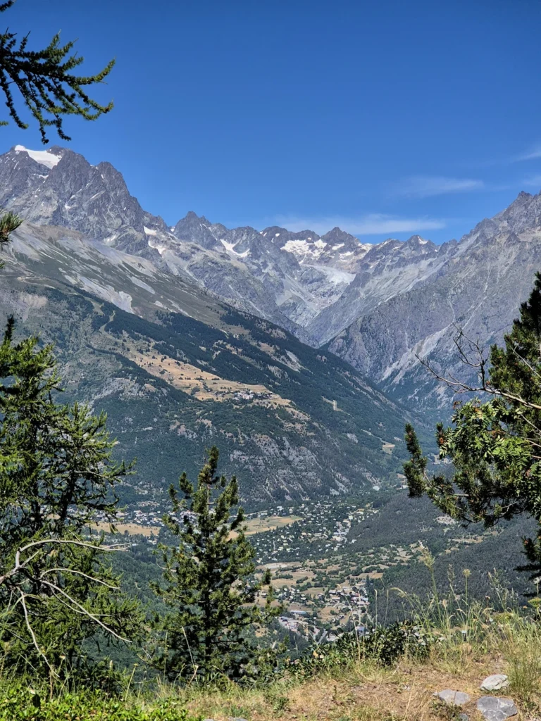
The 4×4 track takes over, wide but steady. The gradient becomes steeper, the switchbacks follow one another and the thighs quickly heat up. Fortunately, the panoramas that gradually open up provide excellent excuses for a photo break. It takes around 3 hours to reach the col de Pousterle (1763 m), taking your time – and I’m taking it. The route climbs steadily over almost 400m of ascent, in a mineral and forest atmosphere.
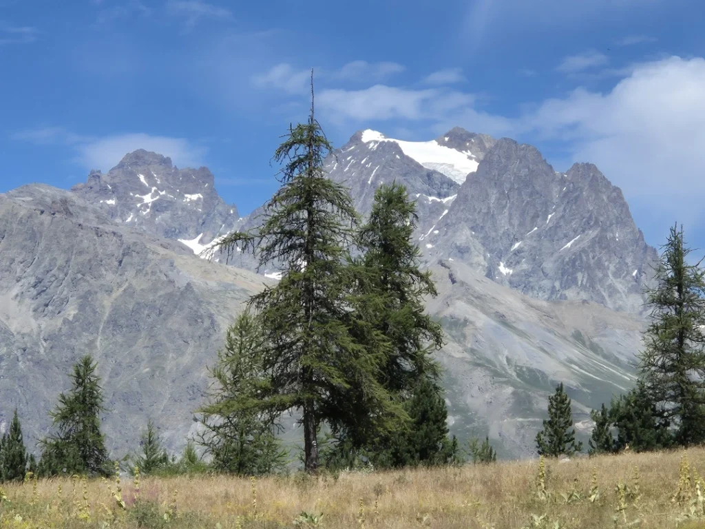
Up there, the giants keep watch
Once over the pass, the world changes. You look out over the great summits of the Écrins massif: Mont Pelvoux, Pic Sans Nom, Ailefroide, and in the distance, a few familiar peaks of the Vallouise. It’s one of those tipping points where you feel tiny… but happy to be so.
The descent: where it all begins
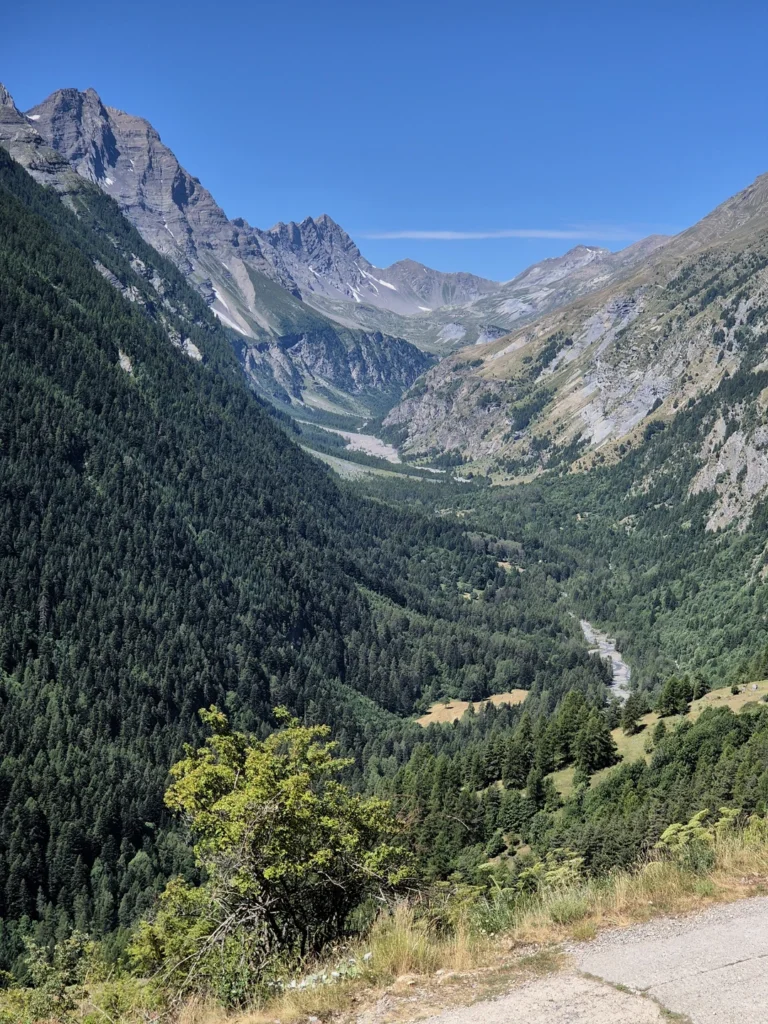
A few more metres of ascent on a forest track, then we attack the descent via the famous undergrowth single. There’s no time for daydreaming here. The route is challenging, demanding and narrow. There’s a succession of tight hairpins, rock gardens, and a few fast sections.
It’s technical, sometimes rough, but also incredibly beautiful. A great reward for those who love a descent that has to be earned. The single finally leads to a sublime viewpoint over the Durance valley, just before heading back towards L’Argentière.
Practical info
Path type: loop
Distance : 21 km
Elevation gain: +900 m
Duration : 3h for the keen sportsman / 4h30 for the contemplative.
Level: very difficult (long climb + technical descent)
Départ / Arrivée : parking à centre de L’Argentière-la-Bessée
Main attraction: views of the emblematic peaks of the Écrins massif, technical descent through the forest
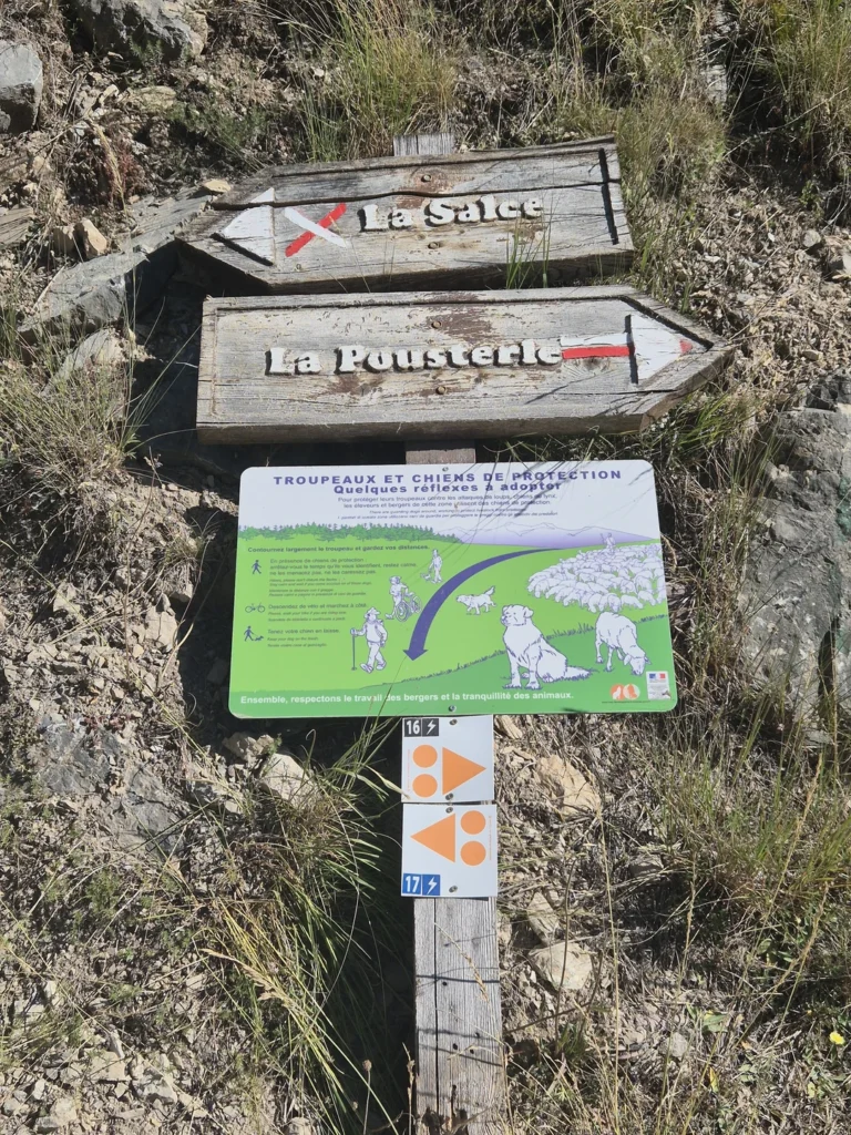
Signposts: route no. 16 black – topo available at paysdesecrins.com
What to bring :
A well-tuned mountain bike (and tubeless, if possible 😉 )
Helmet, gloves, plenty of water
Repair kit (multi-tools, patches, pump)
And a smartphone for the photos, because there’ll be plenty to do…