The climb is very technical – says a lady hiker we met on the summit of Signal (Massif Alaric, not far from Carcassonne). – We’re going to return via the fire road.
I am looking at a small stone painted in red and white. This is where the GR 77 starts. Apparently very technical. Even on walk. And we’re thinking of biking down it…
Route description


Getting to the site : : You can leave your car in a small car park behind the motorway. Better to come early, there are not too many places.
For this ride, we have taken part of trail no. 16 of ESPACE VTT-FFC RONDE AU CŒUR DES CORBIÈRES.
For whom: The climb is easy, but long (almost 500 m elevation).
 The first part of the descent can be done on a bike (very good technical level required) or by putting your foot down on two steep but very short passages.
As soon as you join the official MTB circuit n°16, the single becomes quite easy, accessible to all Sunday bikers.
Equipment : If you ride fast, I strongly recommand to use extra protection (knee pads, elbow pads…). The terrain is rough and rocky.
 GPX file
Photo album
 The car park near Moux.
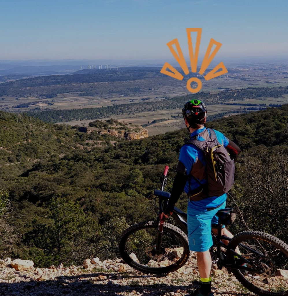
 A splendid view over the Minervois plain.
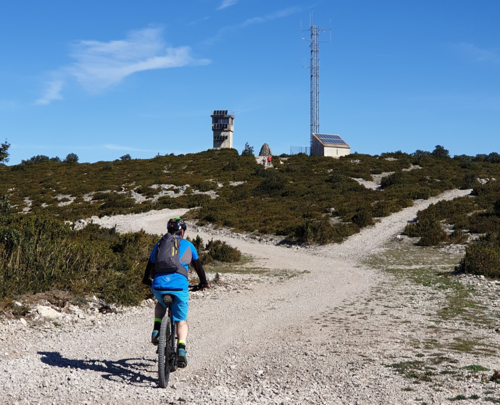
 The climb to Alaric is monotonous, but rolling.
View on Canigou sommet

We put on our protective gear and set off on a , rocky single.

 The single becomes very pleasant, turns between the bushes, sometimes plunges in the very dense shade under the trees.

At the intersection with the forest road you reach circuit no. 16 of ESPACE VTT-FFC RONDE AU CŒUR DES CORBIÈRES.

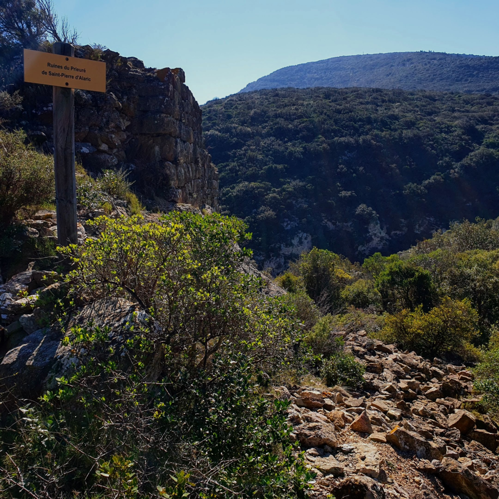
 The last break is next to the romantic ruins of Château Saint-Pierre. We take a last look at the Signal.